Write messages, send voice messages, share pictures and files. Globally via Tor and the decentralized network of HeyAppPro nodes. End-to-end encrypted on your device: The nodes do not receive keys to read.
END-TO-END
02 / CALLING In development
Your voice. Privately connected.
A phone icon in the chat: it rings, your contact answers and you speak simultaneously. End-to-end encrypted, exclusively over Tor, with no recording. Each direction takes a few seconds over Tor; headphones are recommended. Video and group calls will follow.
ON A CALL · BOTH DIRECTIONS
03 / EMERGENCY COMMUNICATION In planning
When the internet fails.
Crisis communication with HeyAppPro. HeyAppPro provides the PlugIn infrastructure; third parties provide the transmission paths: LoRa-Mesh with Meshtastic and MeshCore, amateur radio networks such as HAMNET, AREDN, Winlink and APRS, and digital and trunked radio such as DMR and TETRA. In a disaster, amateur radio operators or authorities' technical services can quickly enable alternative communication paths. Text messages and locations keep flowing in the same app, with the same contacts and conversation history. Each message shows which channel it uses.
HAM Radio & Mesh Networks
HeyAppPro nodes should also be operable in other mesh networks and integrable into existing networks. This creates an independent communication network locally. The goal is full local HeyAppPro functionality in suitable, sufficiently powerful mesh networks – even when the internet fails.
Functionality depends on the specific radio network: Narrowband LoRa networks like Meshtastic and MeshCore are intended for text and locations. External services and new alerts still require an accessible data source. For HAM radio, the respective operating conditions apply.
Separate plugins for Meshtastic, MeshCore, and other radio networks are planned. The connections are developed and operated by third parties; they are not yet available.
Messages and attachments disappear from the local app storage after 24 hours. Exported copies remain outside this deletion.
07 / GROUPS In development
Together. Only by invitation.
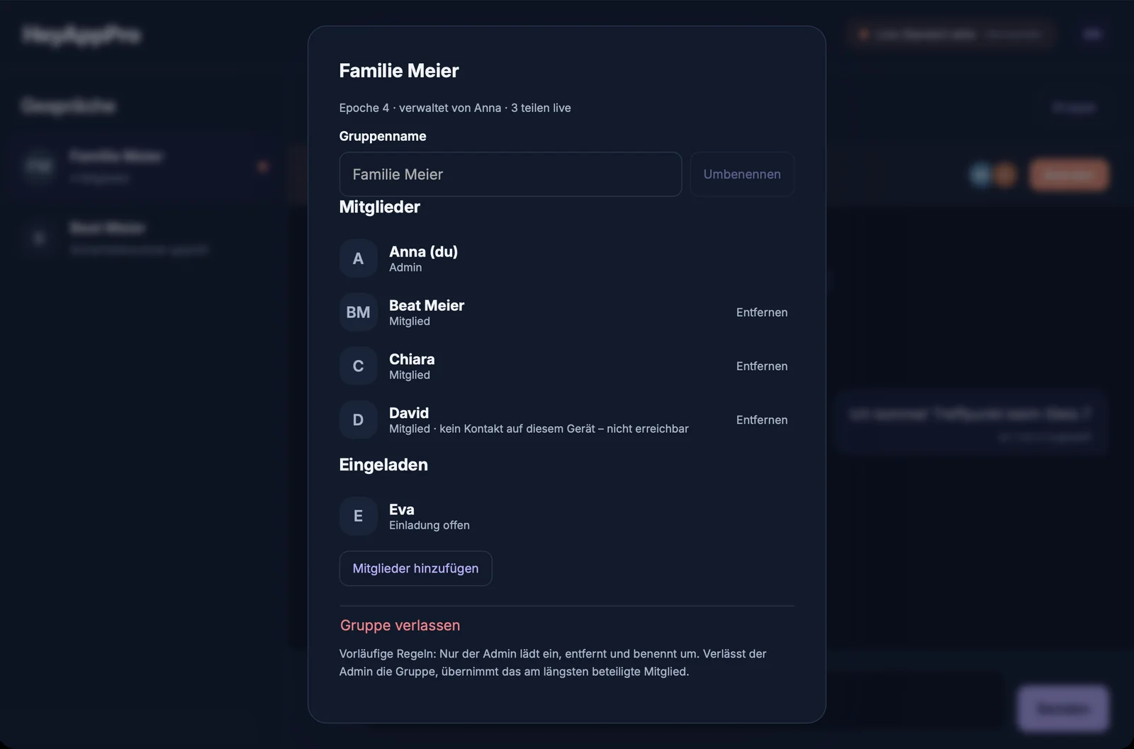
Groups from your contacts: up to 50 people with Private, 100 with Business, 256 with Business Pro, and 500 with Gov. Joining only after acceptance. Text, attachments, voice messages, and location in the same thread. Those who are removed no longer receive new keys. No central group server.
ANBWLMSKRTEXNEW KEYS ONLY FOR MEMBERS
08 / LOCATION In development
ANLMMapAerial View
Where are you right now?
Send once or share live: 1 to 12 hours, updated every approx. 15 seconds. All sharers on a common map: OpenStreetMap street map or swisstopo aerial view, map tiles over Tor. Positions are deleted after the session ends.
09 / RADIO In development
Press. Speak. Release.
Walkie-talkie in chat: hold the button, speak and release. Incoming transmissions ring first; after you select “Accept”, subsequent transmissions play directly until you end the walkie-talkie session. Short segments, individually encrypted over Tor, audible after a few seconds.
HOLD · SPEAK · RELEASE
NEW IN PRODUCT CONCEPT · FREE ADD-ON
Understand hazards. Find help.
At home, travelling or in a crisis: HeyAppPro connects worldwide hazard information with your location. The alert database is already running; the following app features are being developed or prepared.
WARNINGS In development
The world in view. Your surroundings in focus.
Earthquakes, fires, floods, severe weather, tsunamis, or evacuations: classify relevant reports by location and hazard type, view warning areas on the map, and open the original source. Coverage depends on the connected sources.
EARTHQUAKE In development
Has there been an earthquake near you?
Planned alerts cover earthquakes of magnitude 3 and above within 150 km, from the last two hours. Distance, time and source help you assess them. This is a report of a detected earthquake, not a guaranteed early warning.
FIRE In development
Heat sources around you.
NASA satellite data supplements the warning situation: thermal anomalies from the last five hours within a 50 km radius, with distance, direction, and capture time. A measurement point is not a confirmed forest fire; official reports provide additional context.
MEDICAL ASSISTANCE In planning
Unfamiliar city. Help nearby.
Find the nearest suitable hospital, medical practice or other assistance facility, starting from your location or a place you choose. With distance, address, direct contacts and local emergency numbers. Opening hours and specialist services where documented; available treatment capacity is not assumed.
EMBASSY & CONSULATE In planning
Lost your passport? Keep your bearings.
Find the appropriate embassy or responsible consulate worldwide: with visiting address, contacts, and consular emergency number, where available. Your country of origin and jurisdiction are key – not just the shortest distance.
LOCAL EMERGENCY NUMBERS In planning
The right number. In the right place.
Ambulance, police, fire service, poison advice or mountain and maritime rescue: find documented contacts for your country and region. Direct facility contacts and emergency numbers remain clearly separate, with source and verification status visible.
NAVIGATION In development
From location to destination.
Distance and direction to a selected location at a glance. A compass arrow helps with orientation; the destination can be passed to Apple Maps, Google Maps, or a suitable map app. The selected app handles route planning.
YOUR SETTINGS In development
You decide what reaches you.
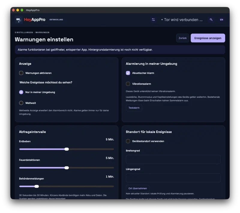
Optionally activate warnings, view local or global events, and adjust polling intervals, tone, and vibration. The warning location is independent of location sharing in the chat. Translations on demand into your language are planned; the original remains accessible.
Worldwide coverage is the expansion goal, not a promise of complete alerts or assistance listings. Mobile delivery and background alerts are still pending. The add-on complements official warnings and the local emergency number.
A LOOK INSIDE HeyAppPro
Real interface. Real maps.
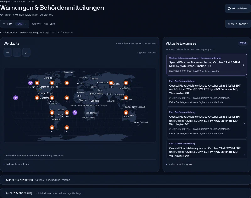
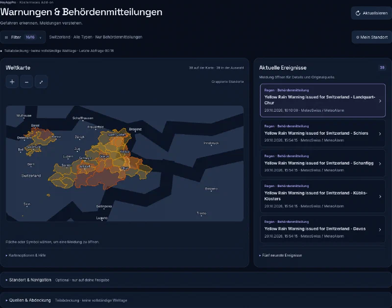
Current development captures: The administration console for Business Pro and Gov shows real geographical data and alerts. The app views show the development status with sample data.
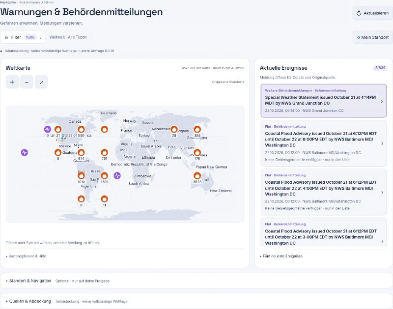
World Map · Business Pro & GovWorld map with country borders, city names, and warning markers. Original capture of the administration console from October 22, 2026; the data sources cover a portion of global events.
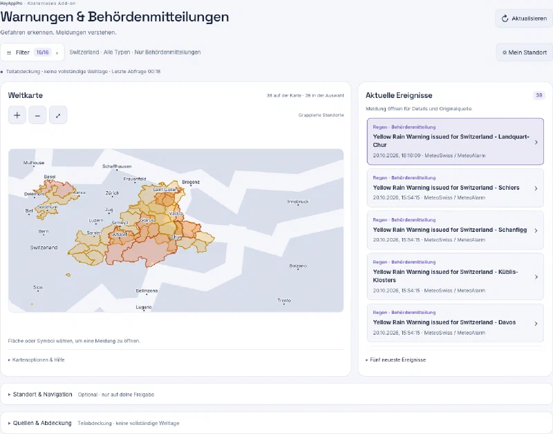
Swiss Warning Areas · Business Pro & GovSwiss warning areas and associated official reports on a real geographical map. Original capture from October 22, 2026.
Your alerts. Your settings.Original screenshot of the native macOS app from 21 October 2026. Display, sound, intervals and location are configurable. Development status: background alerts are not yet available.
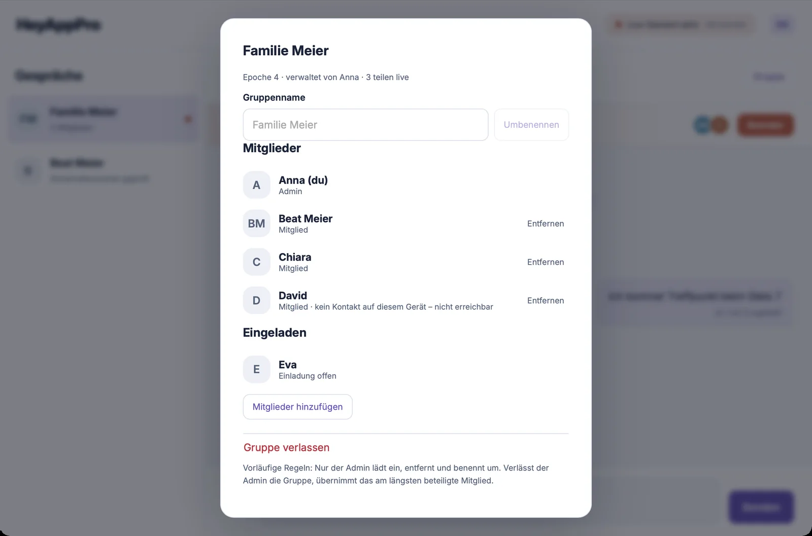
Connected togetherMembers, roles, and open invitations at a glance. Real app interface from development with sample data.
HeyAppPro ON THE IPHONE
Calling. Directly in your app.
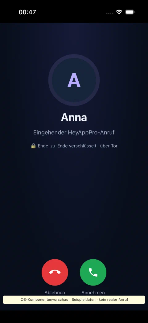
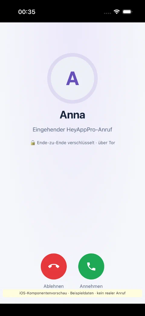
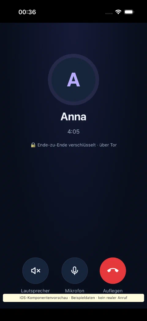
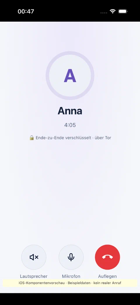
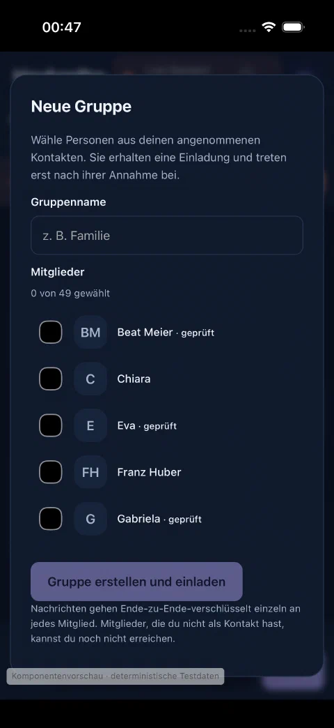
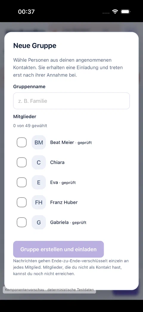
New views from the iPhone simulator: Answering calls, staying in a conversation, and creating a group. iOS component preview from the app code, development status with sample data. The call screens do not show a real call.
A call for youIncoming call with clear buttons to accept and reject. iOS view with example data.
Everything for the conversationCall duration, speaker, microphone, and hang up on one screen. iOS view with example data.
Your next groupName a new group and select contacts for invitation. Private example view for a group of up to 50 people.
Your devices. Your everyday life.
macOS · Linux · Windows Web access with local core